
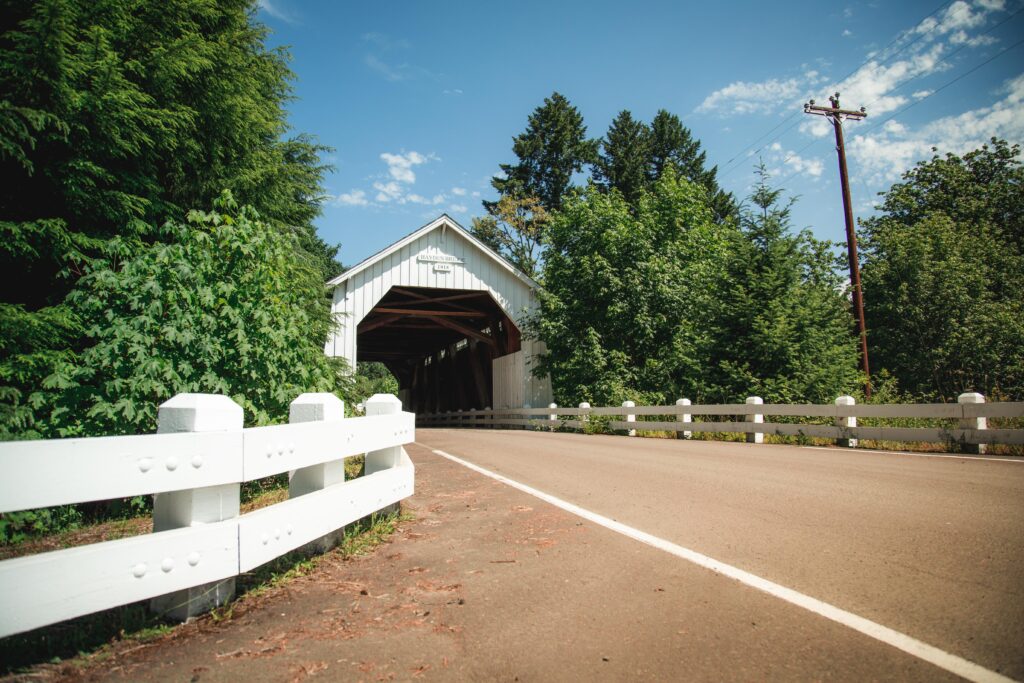
Floodplain
Floodplains & Flood Damage Prevention
Benton County actively helps people living and building in or near a floodplain understand their flood risk. The county has approximately 57,000 acres of land mapped as flood hazard and nearly 3,200 individual properties are located partially or entirely within a flood hazard area.
Helping our floodplains function is a community effort. Our goal is to help you decrease damage to your home and property during flood events, keep your belongings high and dry during flood events, and help you get back to your everyday life quickly after floods happen.
Help us help you to build responsibly!
Benton County shares the following types of floodplain information with the public:
- Flood hazard maps to help you decide where to build safely
- Elevation certificates for many houses and buildings
- Local historic flood information
- Floodplain construction requirements so you know how design your future projects
- Help identifying and evaluating mitigation projects – such as adding flood venting to protect your foundation or raising your home to keep it high and dry – to improve protections for your existing home and decrease damage from flood events
- Natural and scenic areas you can visit that provide flood protection and important habitat for wildlife
Benton County mails flood information to owners of land in county flood hazard areas each year. The pamphlet includes information about:
- How to identify your flood risk
- What to do before, during, and after a flood
- How to reduce flood damage risks for your structure
- Who to contact for more information
Check out this resource: Know Your Flood Hazard: A quick flood guide
Natural hazards & planning for the future
Did you know Benton County has a Benton County’s Natural Hazards Mitigation Plan? This plan identifies all hazards – winter storm, wildfire, earthquake, flood, drought, etc. – that affect Benton County and a wish list of projects that can help lessen the impacts to residents when these things occur.
You can help Benton County become a resilient place to live, work, and play by:
- Reading about the hazards that affect our county in Natural Hazard Mitigation Plan
- Reviewing the list of action items (project wish list) in Section 3 of the plan and letting us know what’s missing
- Signing up for the Linn-Benton Alert system – a free emergency notification service operated by Benton and Linn Counties.
- Checking on your neighbors, friends and family to make sure they are okay before, during and after storms and other disaster events.
- Help spread the word!
Building in a floodplain: Know before you build
The safest place to build is outside the floodplain but, if you need to build in a floodplain, there are key considerations and steps need to be followed to successfully get a permit.
Navigating the process to build in a floodplain and providing documentation is key to protecting your investment and ensuring prompt approval of your application. For important information that will help you on your journey, check out our resource “Know before you build”. This step by step tool, identifies how to successfully navigate the entire permit process for building in Benton County.
Before you use our “Know before you build” tool, there is some helpful information to keep in mind:
What counts as “development” in a floodplain?
“Development” in a floodplain is defined as:
Any man-made change to improved or unimproved real estate, including but not limited to buildings or other structures; fences; bridges and culverts; mining, dredging, filling, grading, paving, excavation or drilling operations; or storage of equipment or materials located within the special flood hazard area.
This definition includes more than just building houses and bridges. Here are some things you might not normally think of that are also included:
- Building a small structure like an RV cover or a chicken coop that doesn’t require a building permit
- Remodeling your house including things like hanging drywall and replacing, repairing, and installing windows, counters, flooring, and roofing
- Removing a building from your property
- Ground disturbance projects such as digging a hole, filling a low spot, building a fence or retaining wall, widening a driveway, or adding a patio or swimming pool
- Vegetation adjustments like adding, removing or replacing trees or other vegetation
- Habitat and riparian restoration projects including add vegetation near a stream, creating fish refuge areas, adding bundles of large woody debris, replacing stream crossings
- Repairing, replacing or adding culverts to access your property
- Road improvements such as bridge repair and replacement, road widening, and road resurfacing
Some of the projects listed above may not require a separate building permit or land use approval but they all require a Floodplain Development Permit. If someone else will be doing the project for you, remind them to get floodplain development approval before they begin
Remember: A floodplain development permit is required for all development in the floodplain, even if the work does not require a regular building permit or land use approval.
What is a floodplain development permit and how do I know if I need one?
- An approved floodplain development permit gives you permission to do your project, identifies any necessary conditions, and documents that your project meets Benton County floodplain requirements.
- Any time you are doing a project that is considered “development” in a floodplain, you need a floodplain development permit. This is true even if you don’t need a construction permit or any other permits.
- Visit the Benton County “Know before you build” tool for more information and links to the floodplain development permit application form.
What are some key things I should know about building houses, manufactured dwellings, commercial/industrial and accessory buildings in a floodplain?
Building new houses, manufactured dwellings and commercial/industrial office buildings[TL1]
- To keep people and belongings safe, these buildings are not allowed in the floodplain if the property has been vacant for at least one year and there is available building space outside the floodplain.
- If there is not enough space outside the floodplain to build, contact the floodplain manager right away to find out what requirements to plan for.
- If you are allowed to build in the floodplain, you will need a floodplain development permit and you will need to hire a surveyor.
- Buildings in the floodplain must be built with the first floor at least 18 inches above the Base Flood Elevation so that flood waters will be less likely to damage the structure and your belongings.
Building on a crawlspace foundation
- Crawlspaces in floodplains must have flood vents that let water automatically flow through your foundation wall during flood events. This helps keep your foundation from cracking or failing while water is surrounding your building.
- Flood vents must be installed below the Base Flood Elevation and not more than 12 inches above the adjacent grade.
- Flood vents can have screens but they must remain uncovered at all times. This means no flaps, louvers, Styrofoam blocks, or anything else that would have to be moved by hand to let water flow through the vent.
- You need at least two flood vents that are located on separate foundation walls. Installing more than two flood vents is recommended.
- For standard flood vents, you need 1 square inch of vent space for each 1 square foot of your building footprint.
- If you choose engineered flood vents, you usually won’t need to install as many vents in the foundation. One engineered flood vent will usually vent at least 200 square feet of a building’s footprint.
- Contact the floodplain manager for more information.
Building an accessory structures
- These can be tricky! The rules changed in October 2021 so contact the floodplain manager before designing your new accessory structure.
- Accessory structures include things like garages, shops, storage buildings for agricultural equipment, barns, sheds to store items, etc.
- You will need a floodplain development permit, even if you don’t need a building permit, and you might need to hire a surveyor.
- Most accessory structures need to be built with the floor at least 18 inches above the Base Flood Elevation.
- Some accessory structures are limited to a maximum footprint of 600 square feet and a maximum height of one story.
Building new commercial or industrial buildings
- These include buildings for businesses, churches, schools, hospitals, timber products, agricultural processing, etc.
- To keep people and belongings safe, these buildings are not allowed in the floodplain if the property has been vacant for at least one year and there is available building space outside the floodplain.
- If there is not enough space outside the floodplain to build, these buildings must be built with the first floor at least 18 inches above the Base Flood Elevation so that flood waters will be less likely to damage the structure and your belongings.
If the building meets the definition of a “critical facility”, it must be built with the first floor (a) at least 3 feet above the Base Flood Elevation or (b) at least as high as the 500-year flood elevation, whichever is higher.
Remember: A floodplain development permit is required for all development in the floodplain, even if the work does not require a regular building permit or land use approval
What are some key things I should know about repairing or replacing houses and accessory buildings in a floodplain?
Replacing houses and manufactured dwellings
- If your replacement home is in or near a floodplain, contact the floodplain manager before you start designing your dream home so that you know what requirements to plan for.
- You will need a floodplain development permit, and you will need to hire a surveyor.
- The first floor has to be at 18 inches above Base Flood Elevation so that flood waters will be less likely to damage the structure and your belongings.
Repairing a damaged home
- Any time your home is damaged (even if it’s not damaged by flood), contact the floodplain manager right away (before you begin fixing things).
- You will need a floodplain development permit, even if you don’t need a building permit, and in some cases, you might need to hire a surveyor.
- The cost of repairing the damage will be compared to the market value of your building before it was damaged.
If the cost to repair the damage is substantial, you might need to include additional improvements to the rest of your home so that it meets current floodplain requirements. - Substantial damage repair means that the cost to repair the damage is at least 50% of the market value of the building right before it was damaged.
Example:
Cost of project = $56,000
Market value of building before damage = $112,000
($56,000 / $112,000) = 0.50; 0.50 * 100 = 50%
Repairing electrical, mechanical, heating, ventilation, plumbing and comparable equipment
- This includes outdoor items like heat pumps, cross-over ducts, generators, irrigation pumps, etc. as well as indoor items like furnaces, water heaters, electrical outlets and panels, etc.
- The requirements are different depending on if the item is attached to a building versus mounted to a pole somewhere on the property.
- Contact the floodplain manager for more information.
What are some key things I should know about remodeling or adding to houses or accessory buildings in a floodplain?
Remodeling or renovating an existing home
- Before you remodel or renovate your home or have someone design your dream home makeover, contact the floodplain manager to discuss floodplain requirements so that you can plan your project in a cost-effective way that protects your investment.
- You will need a floodplain development permit, even if you don’t need a building permit, and in some cases you might need to hire a surveyor.
- The cost of doing your project will be compared to the current market value of your building.
If your project cost is substantial, you might need to include additional improvements to the rest of your home so that it meets current floodplain requirements. - Substantial improvement means that the cost of doing your project is at least 50% of the current market value of the building.
Example:
Cost of project = $56,000
Market value of building before damage = $112,000
($56,000 / $112,000) = 0.50; 0.50 * 100 = 50%
Adding onto an existing home
- Before you have someone design the addition of your dreams, contact the floodplain manager to discuss floodplain requirements so that you can plan your project in a cost-effective way that protects your investment.
- You will need a floodplain development permit, even if you don’t need a building permit, and in some cases, you might need to hire a surveyor.
- If you want to increase your building footprint by more than 10%, you might need to use a post, pier, or pile foundation instead of a crawlspace or slab-on-grade foundation. The cost of doing your project will be compared to the current market value of your building.
- Depending on the cost of your project and the floor height of your current house, the floor of your addition might need to be higher than the floor of your house.
- If your project cost is substantial, you might need to include additional improvements to the rest of your home so that it meets current floodplain requirements.
- If your project cost is substantial, you might need to include additional improvements to the rest of your home so that it meets current floodplain requirements.
Substantial improvement means that the cost of doing your project is at least 50% of the current market value of the building.
Example:
Cost of project = $56,000
Market value of building before damage = $112,000
($56,000 / $112,000) = 0.50; 0.50 * 100 = 50%
Altering accessory structures
- These can be tricky! The rules changed in October 2021 so contact the floodplain manager before designing your new or renovated accessory structure.
- Accessory structures include things like garages, shops, storage buildings for agricultural equipment, barns, sheds to store items, etc.
- You will need a floodplain development permit, even if you don’t need a building permit, and you might need to hire a surveyor.
Most accessory structures need to be built with the floor at least 18 inches above the Base Flood Elevation. - Some accessory structures are limited to a maximum footprint of 600 square feet and a maximum height of one story.
Installing electrical, mechanical, heating, ventilation, plumbing and comparable equipment
- This includes outdoor items like heat pumps, cross-over ducts, generators, irrigation pumps, etc. as well as indoor items like furnaces, water heaters, electrical outlets and panels, etc.
- The requirements are different depending on if you’re replacing an existing item versus installing something new and depending on if the item is attached to a building versus mounted to a pole somewhere on the property.
- You will need a floodplain development permit, even if you don’t need a building permit and, in some cases, you might need to hire a surveyor.
- Most of the time, these items need to be at least 12 inches above Base Flood Elevation or must be watertight during flood conditions. Some exceptions to the 12-inch requirement are available for structures built before 1986.
- Contact the floodplain manager for more information.
When do I need to hire a surveyor for my project?
For some projects, you will need to turn in several elevation certificates: before you get a permit, during construction, and after your project is done.
Elevation certificates must be prepared by an Oregon-registered Professional Land Surveyor or by an Oregon-licensed Civil Engineer. Need help finding a surveyor? Use the Professional Land Surveyors of Oregon website to find a surveyor near you.
Elevation certificates are required for these types of projects:
- New buildings
- Replacement buildings
- Substantial improvement of buildings
- Repair of substantially damaged buildings
- Additions to existing buildings
Elevation certificates are needed at three stages during your project:
Before you get a permit – Pre-construction elevation certificates
- This certificate is for the building site. It records the flood elevation and the existing ground elevation.
- Have your surveyor fill out this certificate when you know where you want to put your building or where you want to add on to your building.
- Ask your surveyor to contact the Floodplain Manager before filling out the certificate if:
- You are adding on to your building
- Your surveyor has not submitted an elevation certificate to Benton County before
- Your project is in flood Zone A (where flood elevations are not shown on the flood maps).
- Before you plan your project, show this certificate to the Floodplain Manager and ask for a meeting to discuss your ideas and find out which floodplain requirements you will apply to your project.
- Turn in the original certificate with your floodplain development permit when you apply for your construction permit.
During construction – Mid-construction elevation certificates
- This certificate records the floor elevation for your building and helps make sure that the floor is high enough before you finish construction. (It’s expensive if the floor is too low and the whole building has to be raised after it’s constructed!)
- For all other dwelling projects, have your surveyor fill out this certificate after the lowest floor is in place and before any vertical walls are constructed. The certificate will need to be approved before you can get approval for an underfloor inspection.
- For pole barns, have your surveyor fill out this certificate after the floor is in place. The certificate will need to be approved before you can get approval for a slab inspection.
- Turn in the original certificate to the Floodplain Manager for review and approval.
After your project is done – Post-construction elevation certificates
- This certificate records all the required information to show that your building complies with the floodplain requirements. It shows flood and floor elevations, mechanical equipment and exterior grade elevations, number and size of flood vents, etc.
- Have your surveyor fill out this certificate after all the utilities have been placed and all final grading is done. The certificate will need to be approved before you can get approval for a final inspection.
Need help locating a surveyor? Use this page to help find surveyors to complete an elevation certificate for your project site.
What is a Letter of Map Amendment (LOMA) and when is it helpful to have one?
- A Letter of Map Amendment is used to show that the existing ground elevation – for your building site or for a larger area of your property – is already higher than the flood elevation.
- Your surveyor can fill out an application for Letter of Map Amendment and submit it to FEMA for review and approval.
- An approved Letter of Map Amendment is FEMA’s formal agreement that the land is higher than the flood elevation.
- You can submit a Letter of Map Amendment instead of an elevation certificate with your floodplain development permit.
- If your mortgage requires you to have flood insurance, you can also show the Letter of Map Amendment to your lender. The lender can still choose to require flood insurance as an additional protection of their interest, but they are not required to do so.
What should I know when I talk with a surveyor?
It’s helpful to tell the surveyor:
- The type of flood zone for your project location: Zone A (no flood elevations mapped) or Zone AE (flood elevations are mapped).
- That you will need three elevation certificates or (if your project site is high enough above the flood elevation) a Letter of Map Amendment.
- If you are interested in requesting a Letter of Map Amendment from FEMA.
It’s helpful to ask the surveyor if they:
- Regularly fill out elevation certificates.
- Have submitted elevation certificates to Benton County.
- Have filled out elevation certificates for building sites in flood Zone A.
- Have submitted requests for Letter of Map Amendment to FEMA.
If your surveyor’s answer to any of the above items is no, please have them contact the Floodplain Manager to discuss your project and Benton County’s elevation certificate requirements.
Getting permission to do work in a floodplain
Why is a Floodplain Development Permit Required?
Floodplain development permits help you protect your investment and minimize your risk of damage during and after flood events. Your project is reviewed to make sure:
- Buildings are reasonably safe from flooding by keeping floors high enough, making sure foundations are open or vented, and using construction materials that are resistant to flood damage
- Mechanical, electrical, and plumbing equipment is installed high enough to keep it reasonably safe from flooding
- Ground disturbing projects allow flood water to remain in place during a flood and are designed in a way that won’t increase flood risk to existing buildings
Where Can I Get an Application Form?
Floodplain development permit forms are available:
- In the Supporting Documents section below
- At the Benton County Community Development office
Floodplain Development Permit – Fill out this form for all projects in a floodplain, even if you also need other building or land use approvals and even if your project location has a Letter of Map Amendment approval.
Floodplain Development Permit Instructions – Use this information to help you fill out the floodplain development permit form.
Land Development Activities in the Floodplain – Fill this form for large projects in floodplains when the project might change the way water flows or is stored during a flood event.
Floodplain Minor Variance – Fill this form only if your building will be used exclusively for agricultural purposes and cannot reasonably be built to protect building contents by elevating the first floor above the flood elevation.
What are Benton County’s Floodplain Requirements?
If you’d like to be more informed about Benton County’s floodplain requirements, take a look at Chapter 83 of the Benton County Development Code. This chapter includes things like:
- Goals focused on:
- Protecting and promoting public health and safety
- Designing projects to reduce dangers from flooding and flood damage
- Encouraging community members to be aware of their flood risks
- Definitions related to developing in floodplains
- Responsibilities for permit review
- Information about record keeping requirements
- Elevation certificate documentation
- Construction requirements for buildings, equipment, storage tanks, and building materials
- Variance information
- Land division and design requirements
- Additional standards that apply in the urban fringe area around the City of Corvallis
Community Rating System and Flood Insurance Discount
Have you heard? There’s a 15% flood insurance discount
Benton County participates in the Community Rating System as a Class 7 community. This means property owners can receive an automatic 15% discount on FEMA flood insurance policies issued for buildings in unincorporated Benton County.
What is the Community Rating System (CRS)?
The Community Rating System is part of FEMA’s National Flood Insurance Program and is designed to encourage communities to help their residents protect themselves and their investments from flood damage while also encouraging recognition of the benefits that floodplains provide when they are protected.
Some of the ways Benton County participates in the Community Rating System are:
- Encouraging or requiring residents to choose building sites that are outside of flood hazard areas
- Making sure buildings constructed in flood hazard areas:
- Are raised at least 18 inches above the expected 100-year flood level
- Have open foundations so water can flow under the building or have vents in the foundation that let water flood through it during a flood event
- Making sure older buildings constructed before the flood maps were created are brought up to current code requirements when they are substantially improved or remodeled
- Sending flood related information each year to all property owners whose property is in a mapped flood hazard area
Learn more about the benefits of the CRS program.
- Protect public health and safety
- Reduce the risk of flood-related hazards, damage, and erosion
- Prevent increases in flood damage due to new construction
- Encourage and incorporate measures that protect natural and beneficial floodplain functions
- Preserve open space areas in and around floodplains
- Inform community residents and agencies of floodplain hazards and benefits
- Encourage acquisition of flood-prone properties and relocation of structures to reduce the risk of flooding
- Facilitate accurate insurance rating
- Promote the awareness of flood insurance
Banks, mortgage companies, and insurance agencies
Take a look at the annual notice to lenders to see what kinds of flood information Benton County has to offer.
- Providing information to customers and residents about:
- The flood hazards on and near their properties
- Things they can do to better protect their homes and buildings
- Past flood events
- Flood insurance – why it’s important, when it’s required, and where to find out more information
- Flood hazard mapping update projects
- Allowing and encouraging floodplains to stay undeveloped so that they can continue to provide natural flood hazard protection as well as beautiful areas for viewing plants and wildlife
Things to know about flood insurance
Both FEMA flood insurance and private flood insurance are available. Make sure to carefully discuss the benefits and limitations of each option with a flood insurance agent before you choose which one is right for you.
- Flood insurance covers more than just river and rain flooding.
- Flood insurance policies cover damage to structures and contents from sudden overland flow of water that flows across at least two properties.
- Sudden overland flow can be from too much rain or a stream overflowing its banks, but it can also be from a neighbor’s outdoor swimming pool if it breaks or from a watermain that ruptures suddenly.
- Two properties can be your property and your neighbor’s property, but it can also be your property and the road right-of-way next to your property.
Flood insurance is available for all properties, including land in low flood risk areas.
- Properties and buildings that are shown in a mapped flood hazard area are typically at highest risk of flooding.
- Properties outside these mapped areas are still at some risk of being flooded, especially if they are on the edge of a mapped flood hazard area or if the flood maps are old and you know water collects nearby.
- Properties near wildfire areas are also at an increased risk of flooding, sometimes for 10 years or more after the wildfire occurred.
It only takes a few inches of water to cause damage that is expensive to repair.
- Water is a powerful thing. Only two inches of water can float an entire car. Two inches of water in your home can cause damage that might cost $20,000 or more to repair, plus the cost of replacing personal belongings.
After wildfires, flood risks increase outside of mapped flood hazard areas.
- Water is a powerful thing. Only two inches of water can float an entire car. Two inches of water in your home can cause damage that might cost $20,000 or more to repair, plus the cost of replacing personal belongings.
Visit floodsmart.gov for more flood insurance information and contact your insurance agent today to make sure your flood insurance policy is current and provides the coverage you need to help you recover after a flood event.
Current River Conditions and Flood Risks


Need Assistance
We are here to help. Make sure to provide the tax assessor’s map and tax lot number and our staff will work to efficiently find you answers to your questions.
Contact our county floodplain manager at (541) 766-6819
Did you know
Benton County’s current Class 7 designation authorizes an automatic 15% discount for flood insurance premiums for Benton County property owners.
Need help finding an insurance provider, the National Flood Insurance Program (NFIP) can help:
(877) -336-2627
Additional Resources
FEMA Flood Resources
FEMA Map Center – Lookup your property to see if it is in the flood zone
Flood Hazard and Preparation
Know your Flood Hazard: A quick flood guide
Sandbagging Techniques for Flood Management
Resources for Building in a Floodplain
County Development Code (Floodplain)
Other Emergencies and Disaster Recovery Resources
Permit Applications & Instructions
Floodplain Development Permit Instructions